
Road Trips
America's Best Summer Road Trip Routes Along the Coast
The article profiles five American coastal summer road trip routes: California's Highway 1 through Big Sur (Carmel to Cambria), North Carolina's Outer Banks along Highway 12, Florida's Scenic 30A alongside Alabama's Dauphin Island Parkway on the Gulf Coast, Maine's Route 1 from Camden to Bar Harbor, and New Jersey's 130-mile Jersey Shore from Sandy Hook to Cape May, with specific stops like Pfeiffer Beach's purple sand, Corolla's wild horses, and Red's Eats' $36 lobster roll.
When the Days Stretch Long and the Coastline Calls
Something changes about a road trip in summer that doesn't happen the rest of the year. The light holds until nine, the AC finally earns its keep, and every exit sign starts to look like a good idea. Coastal highways are where that feeling peaks. Below are five stretches of American shoreline worth building a summer around, from a two-lane cliffhanger in California to a boardwalk in New Jersey that still smells like funnel cake past midnight.
California's Highway 1: Cliffs, Fog, and a Slide That Keeps Reopening
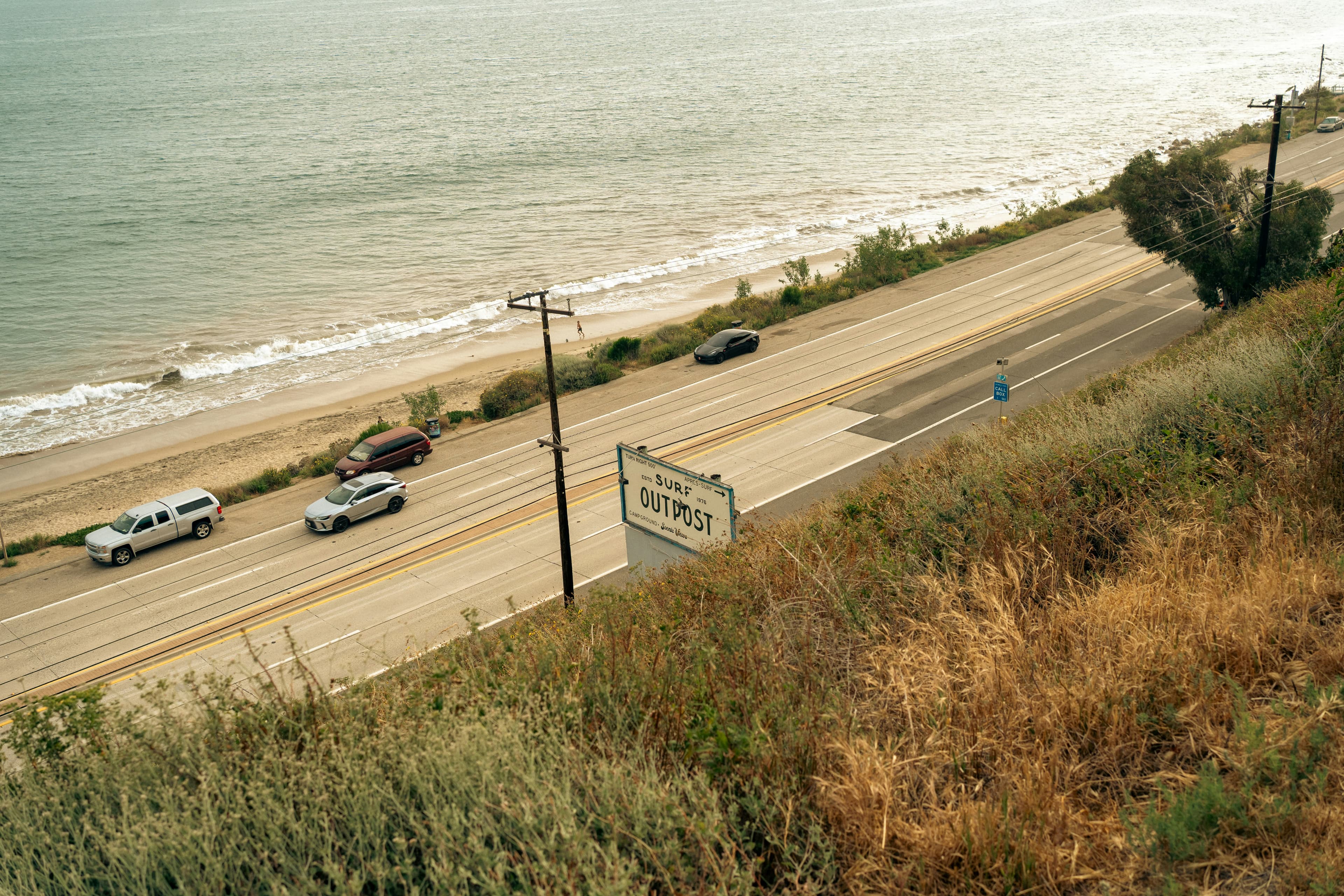
Highway 1 through Big Sur is the road every other coastal drive gets measured against, and the comparison usually isn't fair to the other road. From Carmel south to Cambria runs about 100 miles, but plan on four to five hours if you actually stop, because the pullouts here are not optional. The marine layer that rolls in most summer mornings keeps the cliffs cool even while it's baking in the Salinas Valley just inland, and the fog typically burns off by early afternoon, leaving that famous cobalt water below. One thing worth knowing before you go: this road has a habit of sliding into the ocean. Caltrans reopened the last closed stretch at Regent's Slide in January 2026 after months of one-lane detours, so check the Caltrans District 5 conditions page the morning you leave, not the week before.
Best local stop: Pfeiffer Beach, off mile marker 45.64, sits down a narrow 2.2-mile spur called Sycamore Canyon Road. The $12 entrance fee buys sand that's genuinely purple in patches, tinted by manganese garnet washed down from the cliffs above, plus a view of Keyhole Rock where the surf punches through at sunset. Gates open at 9 a.m. and close at sundown, no exceptions, so time it right.
The Outer Banks: North Carolina's Ribbon of Sand
Highway 12 runs the length of the Outer Banks like a spine, narrowing in places to barely two lanes with dune grass pressing in on both sides. The horses are the real draw up north. The herd near Corolla descends from Spanish mustangs that have grazed this sand since the 1500s, and once the pavement ends, you need four-wheel drive to follow them onto the beach itself. Keep 50 feet back no matter how used to tourists they look. Down south, the Ocracoke ponies live differently, kept in a managed 180-acre enclosure with viewing platforms, a compromise struck decades ago to keep them off Highway 12.
Hidden gem: Getting to Ocracoke means catching a free state ferry from Hatteras, which alone filters out a good chunk of the day-trip crowd. Corolla's year-round population, still under 1,000, swells past 60,000 during peak summer weeks. Book lodging early if that's the stretch you want.
The Gulf Coast: 30A's Green Water and Alabama's Quieter Version
Scenic Highway 30A runs about 24 miles between Panama City Beach and Destin, and somehow that's enough road to hold five distinct beach towns. Seaside, the pastel New Urbanist town built as the film set for The Truman Show, anchors one end; Grayton Beach, older and scruffier, sits at the other with a looser, barefoot feel. Scattered between them are 15 coastal dune lakes, a landform found almost nowhere else on the planet, where fresh water and salt water mix depending on the season and the storms. Stop at Topsail Hill Preserve State Park for the dune lakes without a resort bill attached.
Alabama's Dauphin Island Parkway, a few hours west, is what 30A might look like with the crowds and the real estate money stripped back out. Fewer galleries, more bait shops. Stop at Pelican Reef in nearby Theodore before you even cross onto the island; the crab claws are worth the detour on their own.
Maine's Route 1: Lighthouses, Lobster Rolls, and a 5:30 a.m. Alarm
Coastal Route 1 runs 527 miles from the New Hampshire border to Canada, and the stretch between Camden and Bar Harbor might be the best of it. Camden and Rockland sit about ten minutes apart on Penobscot Bay. Hike Mount Battie in about 45 minutes, or drive the auto road if you'd rather save your legs for later, for the view that ends up on half of Maine's postcards.
Best local stop: Red's Eats in Wiscasset, cash only, no reservations, and a line that can run past an hour by midday. A lobster roll runs around $36 now, which stings less once you're eating it curbside by the bridge. Push on to Bar Harbor, and if you want the sunrise from Cadillac Mountain, the highest point on the U.S. Atlantic coast, book the timed vehicle reservation months ahead. The 5:30 a.m. slots from May through October sell out fast.
The Jersey Shore: 130 Miles of Boardwalk
Not every coastal drive needs cliffs or dune lakes to earn its spot. The 130 miles from Sandy Hook down to Cape May trade scenic overlooks for boardwalks, and that is the entire point. Sandy Hook's seven miles of barrier beach are free to walk, courtesy of the National Park Service, before the drive turns south through Asbury Park's revived music scene and eventually into Cape May: the country's oldest seaside resort, a National Historic Landmark since 1976, all gingerbread porches and salt water taffy.
What ties these five drives together isn't geography. It's a shared refusal to hurry. Whether the payoff is purple sand at mile marker 45, a pony behind a fence, or a $36 lobster roll eaten standing up by a bridge, the destination barely matters once the windows are down. Check the road conditions before you leave, keep the tank full, and let the coast set the pace.
Places in this story
- Highway 1
- Big Sur
- Carmel
- Cambria
- Salinas Valley
- Regent's Slide
- Caltrans District 5
- Pfeiffer Beach
- Sycamore Canyon Road
- Keyhole Rock
- Outer Banks
- Highway 12
Frequently asked questions
- How long does it take to drive Highway 1 through Big Sur?
- The stretch from Carmel south to Cambria is about 100 miles, but the article recommends planning four to five hours if you actually stop at the pullouts, which it calls not optional.
- Is Highway 1 through Big Sur open in 2026?
- Yes. Caltrans reopened the last closed stretch at Regent's Slide in January 2026 after months of one-lane detours, though the article advises checking the Caltrans District 5 conditions page the morning you leave since the road has a history of landslides.
- How do you get to the wild horses on the Outer Banks?
- The wild horse herd near Corolla descends from Spanish mustangs that have grazed the sand since the 1500s; once the pavement ends, you need four-wheel drive to follow them onto the beach, and visitors should keep 50 feet back. The Ocracoke ponies, reached by a free state ferry from Hatteras, are kept in a managed 180-acre enclosure instead of roaming free.
- How much does a lobster roll cost at Red's Eats in Maine?
- A lobster roll at Red's Eats in Wiscasset runs around $36. The restaurant is cash only, takes no reservations, and the line can run past an hour by midday.
- How far in advance do you need to book Cadillac Mountain sunrise reservations?
- The article says the timed vehicle reservation for sunrise on Cadillac Mountain should be booked months ahead, since the 5:30 a.m. slots offered from May through October sell out fast.